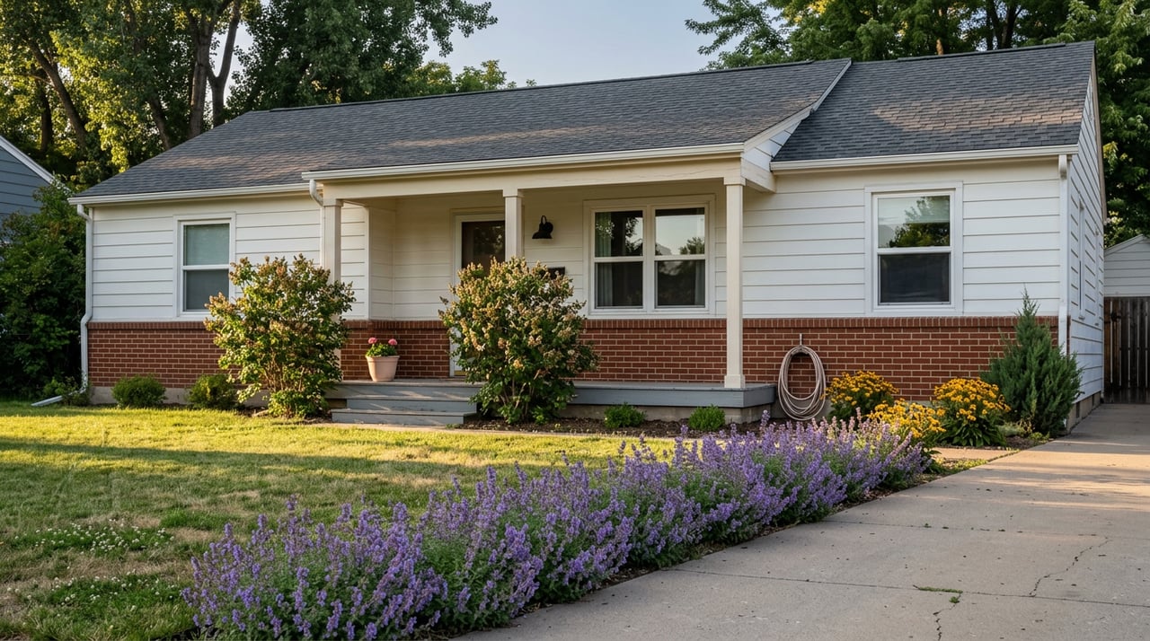
Thinking about a weekend basecamp, a private hunting tract, or a place to ride and explore with Black Hills views? The country around Sundance sits where timbered ridges meet wide‑open prairie, with Devils Tower on the horizon and National Forest next door. You want clean access, clear rules, and a smart plan before you commit. This guide walks you through the land types you will see, the must‑know rules for hunting and riding, and the due diligence that protects your purchase. Let’s dive in.
Sundance area snapshot
Sundance lies on the eastern edge of the Black Hills with the Bearlodge Ranger District based right in town. Large blocks of public land create year‑round recreation options, from scenic drives and hiking to designated motorized routes. If you plan to use nearby National Forest, start with the local office for maps, permits, and current conditions at the Bearlodge Ranger District.
Devils Tower National Monument sits to the northwest and draws buyers who value landmark views and access to regional recreation. Keep in mind that Monument lands are managed differently than National Forest and have stricter rules for hunting and motorized use.
What you can buy near Sundance
Recreational listings around Sundance generally fall into two broad categories. Each offers a different mix of privacy, access, wildlife use, and long‑term maintenance.
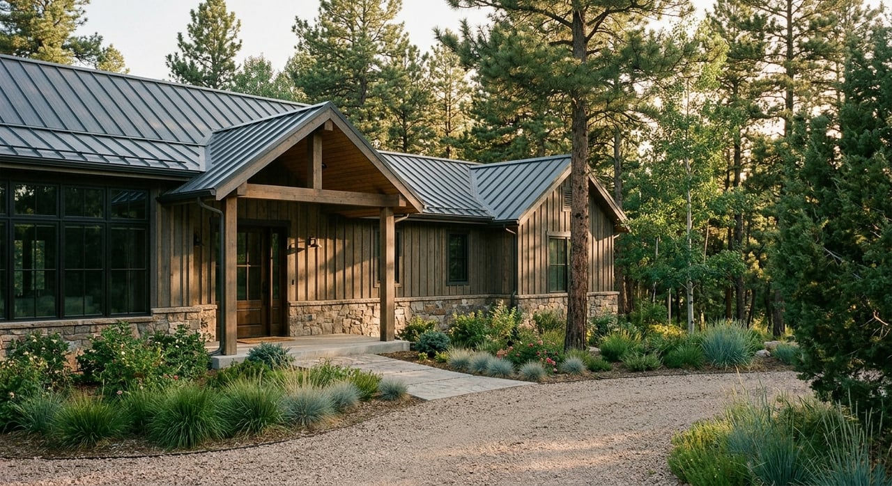
Timbered Black Hills tracts
These are typically 40 to 160 or more acres on forested foothill ridges with ponderosa pine. You will see properties that border or adjoin National Forest, making trailheads and forest roads convenient. Buyers favor these for elk and deer habitat, cool summer shade, and quick access to designated motorized routes. With timber comes seasonal wildfire risk and more complex winter access, so plan for defensible space and verify plowing or snow‑removal responsibilities.
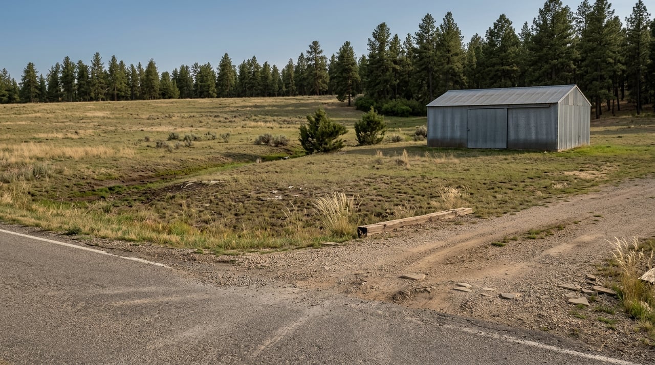
Open pasture and view parcels
Larger, rolling pasture or ranch acreage stretches toward the prairie with big‑sky views of Devils Tower and the Missouri Buttes. These parcels tend to be better for horses, small‑scale haying, and easy sitework. They often have simpler winter access than high‑country tracts. You will still confirm legal access, utilities, and water, but building and maintenance can be more straightforward than in heavy timber.
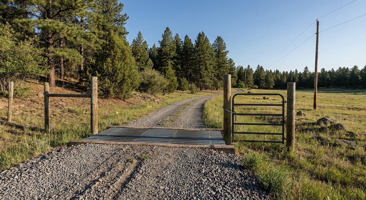
Access and roads: know the three checks
Access near Sundance can include a mix of paved highways, county gravel, private roads, and Forest Service routes. Treat “access” as three separate confirmations and get each one in writing.
- Public approach: Identify which public paved or state roads lead toward the property, then which county gravel roads bring you close.
- County maintenance and winter access: Confirm with Crook County Road & Bridge whether your approach road is maintained, how often it is graded, and if it is plowed in winter. Start with Crook County Road & Bridge for current maintenance practices and notices.
- Legal access and easements: Use county records to verify recorded access, platted road status, or private road agreements. Do not rely on verbal assurances or tire tracks. Ask for the recorded easement and any road‑maintenance agreement as part of your offer.
If part of your route crosses National Forest, remember that only certain roads and trails allow motorized use. The Black Hills National Forest publishes the Motor Vehicle Use Map, which is the legal document for what is open and when. Review the current Motor Vehicle Use Map before you count on an ATV or UTV route.
Hunting and riding rules close to home
Public lands around Sundance span different agencies with different rules. A quick checklist will save you headaches later.
- Motorized routes: Use the Forest Service’s Motor Vehicle Use Map to confirm which roads or trails are open to ATVs, UTVs, or highway‑legal vehicles and whether a permit is required.
- Monument boundaries: Hunting is prohibited within Devils Tower National Monument. Review the Monument’s regulations on the NPS laws and policies page and respect boundary signage.
- State seasons and tags: Wyoming Game & Fish sets seasons, GMU boundaries, and tag requirements for National Forest and private land. Check current units and quotas with the agency before you plan a purchase around a specific hunt.
Water, septic, and building basics
Before you write an offer, verify that the property can support your intended use. In Crook County, the Growth & Development office handles E‑911 addressing, deed reviews, subdivision matters, and small‑wastewater (septic) permits. Their site provides applications and a wastewater specialist contact. Start your permit research with Crook County Growth & Development.
For wells, Wyoming requires a permit from the State Engineer’s Office before drilling a domestic or stock well. Only a licensed Wyoming driller may drill the well, and filings such as the Application for Permit to Appropriate Ground Water are part of the process. Review steps and fees on the State Engineer’s site under ground‑water processes.
Ask the seller up front for any existing records. A good starter packet includes:
- Septic permits and system plan, including any soil or site evaluations.
- Well permit and completion filings, plus any pump test results.
- Any recorded covenants, HOA or improvement‑district documents, and building or utility plans.
Mineral rights: split estates in plain English
Surface ownership does not always include the minerals beneath. In Wyoming, past owners or the federal government often reserved mineral rights, creating a “split estate.” The University of Wyoming Extension advises a title review and, when needed, a mineral‑title opinion to understand what you are buying. Read their plain‑language primer on mineral rights and split estates and plan for a surface‑use agreement if mineral development is possible.
Utilities and connectivity you can count on
Rural power in northeastern Wyoming is typically served by electric cooperatives. Powder River Energy Corporation is the regional co‑op for many Crook County properties. Ask whether power is on site, whether it is overhead or underground, and what line‑extension costs might be. Learn about the cooperative and service context at Powder River Energy Corporation.
Most recreational buyers use propane for heating and cooking, private wells and septic, and a mix of fixed‑wireless or satellite internet. Because service varies by route and elevation, ask the seller for recent internet speed tests and confirm options directly with local providers.
Wildfire, flooding, and site safety
Ponderosa pine country carries seasonal wildfire risk. Expect periodic burn bans and pay attention to local restrictions. If you are buying in the timber, budget for thinning, driveway turnouts for emergency access, and defensible space. Crook County and the Forest Service share seasonal updates and safety notices, and the county manages local road restrictions and closures through Road & Bridge.
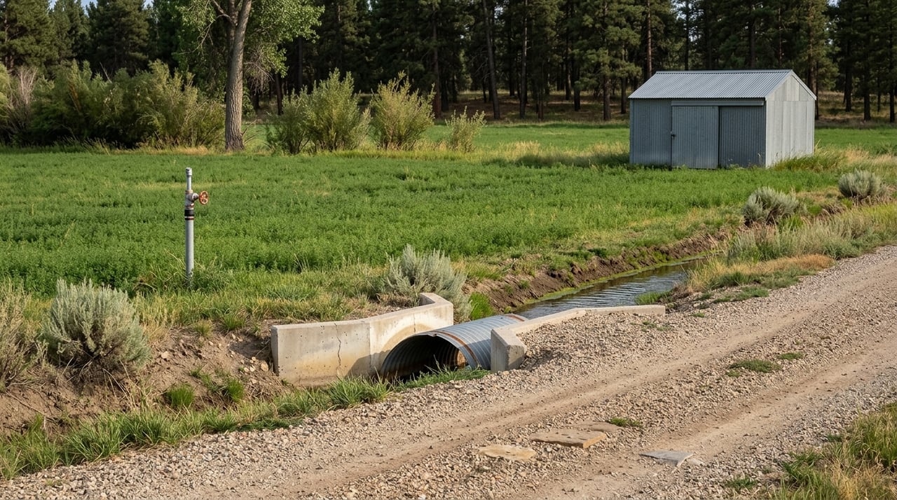
If your parcel includes a creek, draw, or wet meadow, review FEMA flood maps and county records before you commit to a building site or septic location. Riparian areas often have additional siting or permit considerations.
Buyer due‑diligence checklist
Use this checklist to structure your offer and inspection window. Each item includes who to call first.
- Legal access and easements. Action: Confirm recorded road or trail easements and any road‑maintenance agreement. Who to call: Crook County clerk/recorder and Growth & Development.
- Year‑round road maintenance. Action: Confirm county road status and plowing. Who to call: Crook County Road & Bridge.
- Water rights and well status. Action: Request well permit and completion filings; if no well, confirm drilling and permit steps. Who to call: Wyoming State Engineer’s Office under ground‑water processes.
- Septic feasibility and permits. Action: Request existing small‑wastewater approvals or commission a soil/site evaluation. Who to call: Crook County Growth & Development.
- Mineral rights and split estate. Action: Order a title commitment that includes mineral schedules and consult a mineral‑title attorney if needed. Who to read: UW Extension’s primer on mineral rights.
- Public‑land adjacency and motorized routes. Action: Verify if the parcel borders National Forest and review the Motor Vehicle Use Map for open routes and seasonality. Who to call: Bearlodge Ranger District in Sundance.
- Hunting boundaries and seasons. Action: Confirm whether Monument or other closures affect your plans; verify GMU boundaries and tag rules with Wyoming Game & Fish. Who to read: NPS rules for Devils Tower.
- Utilities and fees. Action: Verify electric meter location, line‑extension needs, internet options, and any improvement‑district fees. Who to call: Powder River Energy Corporation and local ISPs.
Local resource box
Keep these offices handy as you evaluate properties around Sundance:
- Crook County Growth & Development (Planning). Director: Tim Lyons. Handles addressing, deed reviews, subdivision matters, and small‑wastewater permits.
- Crook County Road & Bridge. Your first stop for county road maintenance and winter access questions.
- Bearlodge Ranger District, Black Hills National Forest. Local guidance on MVUM, permits, and seasonal access.
- Devils Tower National Monument. Monument rules and boundary information for planning recreation near the Monument.
- Wyoming State Engineer’s Office. Permits and filings for domestic and stock wells.
- Powder River Energy Corporation. Regional electric cooperative serving many Crook County properties.
Ready to explore properties with a clear checklist and a trusted land partner? Reach out to NorthStar Realty to walk parcels, review permits, and structure an offer that protects your time and money.
FAQs
What does “legal access” mean for rural land near Sundance?
- It means there is a recorded, insurable right to travel to and from the property, typically via a public road or a recorded easement. Do not rely on historic use or verbal agreements.
Can you hunt near Devils Tower National Monument?
- Hunting is prohibited within the Monument boundary. Outside the boundary, hunting follows Wyoming Game & Fish rules and seasons on National Forest and private land with permission.
Do you need a permit to ride ATVs on Black Hills National Forest roads?
- Many routes are limited to highway‑legal vehicles or require a motorized‑use permit. Always check the current Motor Vehicle Use Map and any seasonal designations before you ride.
How do you permit a domestic well for a recreational property in Wyoming?
- You must apply with the State Engineer’s Office before drilling, and a licensed Wyoming driller must do the work. Request existing permits and completion filings from the seller when available.
Who approves septic systems in Crook County?
- The county’s Growth & Development office manages small‑wastewater permits. A soil and site evaluation is typically required before design and permitting.